


Kinder Reservoir Circular Hike
This hike takes you through 4,000 years of history shaped by ancestors, artisans, and shepherds around Kinder Scout's western edges.

If you’re a believer of sacred geometry, you’ll know the circle symbolises the expansion of consciousness. This hike won’t unlock spiritual enlightenment, but this loop through Kinder’s lesser-known circular archaeological features might shift your perspective in unexpected ways. That’s got to be more valuable than reaching a higher spiritual plane, right?
Kinder’s slopes have been shaped by human hands for thousands of years. Echoes of rituals, agriculture, and industry still reach out through the peat and stone. The signs are there; you just need to know how to look.
This circular route offers glimpses of Kinder’s vital role in shaping the Peak District’s communities. It’s perfect for training your eye and broadening your understanding of the land's layered history. Whether you come for Kinder’s natural beauty or its spiritual or historical significance, you will walk away with a sense of awe for this landscape.
🥾Route summary: Kinder Reservoir Circular Hike
Distance: approx. 9.55km / 5.9 miles
Time: 3.5-4 hours depending on pace and stops
Start/end point: Bowden Bridge Car Park, Hayfield (SK22 2LE)
Route highlights: Kinderlow Cavern (concealed), Neolithic/Bronze Age burial mound, Cluther Rocks quarry ruins and millstones, Kinder Reservoir, Booth Sheepwash
Terrain: Rocky paths, farmland, gritstone edges; some boggy patches around Cluther Rocks and Kinder Reservoir
Facilities: No toilets available, but a pub is near the parking area
Accessibility: Some rocky sections and boggy areas
Hiking GPS file
Download the route via OS maps and follow the app’s instructions for easy navigation. Let me know how you found it via the comments section at the bottom of this post!
⚠️Before you start hiking…
Peat erosion can expose artefacts. Please leave what you find!
The burial mound is scheduled under the Ancient Monuments Act. Avoid climbing on it or letting your dog dig around there.
Respect the fragile moorland ecology and stick to clear paths where possible.

Mysterious mounds and disappearing spaces
Soon after leaving farmland behind and the trail climbs Kinder’s lower slopes. You may spot Kinderlow Cavern on the map, but its grandiose name belies its innocuous appearance. In fact, you’ll struggle to find it.
For decades, tales of Kinderlow Cavern have circulated among cavers and curious hikers. Once considered one of Derbyshire’s most spectacular natural formations, its chambers were described in The History and Gazetteer of the County of Derby (1831) as:
“Kinder Low subterraneous Cavern. Among the many wonderful caverns in Derbyshire, none seem, for extent and internal beauty, more to merit the attention of the curious observer of the hidden works of nature in her wild recesses,...”
“The sides and roof in this part are composed of huge masses of rock, so regularly and compactly united, that it might be the work of an architect: and after going through innumerable chambers, which for extent and loftiness of the roof, are not inferior to the most celebrated in Peak's Hole, they discovered an opening in the floor, through which they with difficulty descended, and found themselves in a part of the cavern which runs in a direction exactly parallel with the part above. Here the largest chamber they had gone through, seemed only as the portico to this amazing cavern : the eye could scarcely reach the lofty ceiling, the sides and floor of which were regularly formed of immense masses of solid rock.”
The History and Gazetteer of the County of Derby
By Stephen Glover
Published 1831

Unfortunately the cave entrance was filled in and concealed with heather. Perhaps to keep sheep from falling in, or to prevent “trespassers” following the award of public access rights. While the truth remains buried, hunting for the lost cavern adds a welcome note of adventure to this walk.
From here, a great gated mound stands watch over Kinder’s foothill. Archaeologists have dated this burial mound to the Neolithic or Bronze age. Beaker pottery and flint tools have been found falling out of the peat nearby, tantalising clues of lives lived with reverence for Kinder.
Its location raises questions. Too short to be of any defensive or navigational importance, the burial mound’s location was nonetheless chosen with deliberation. Perhaps it reminded the living of their ancestral ties, or their association with Kinder?
One thousand years of industry
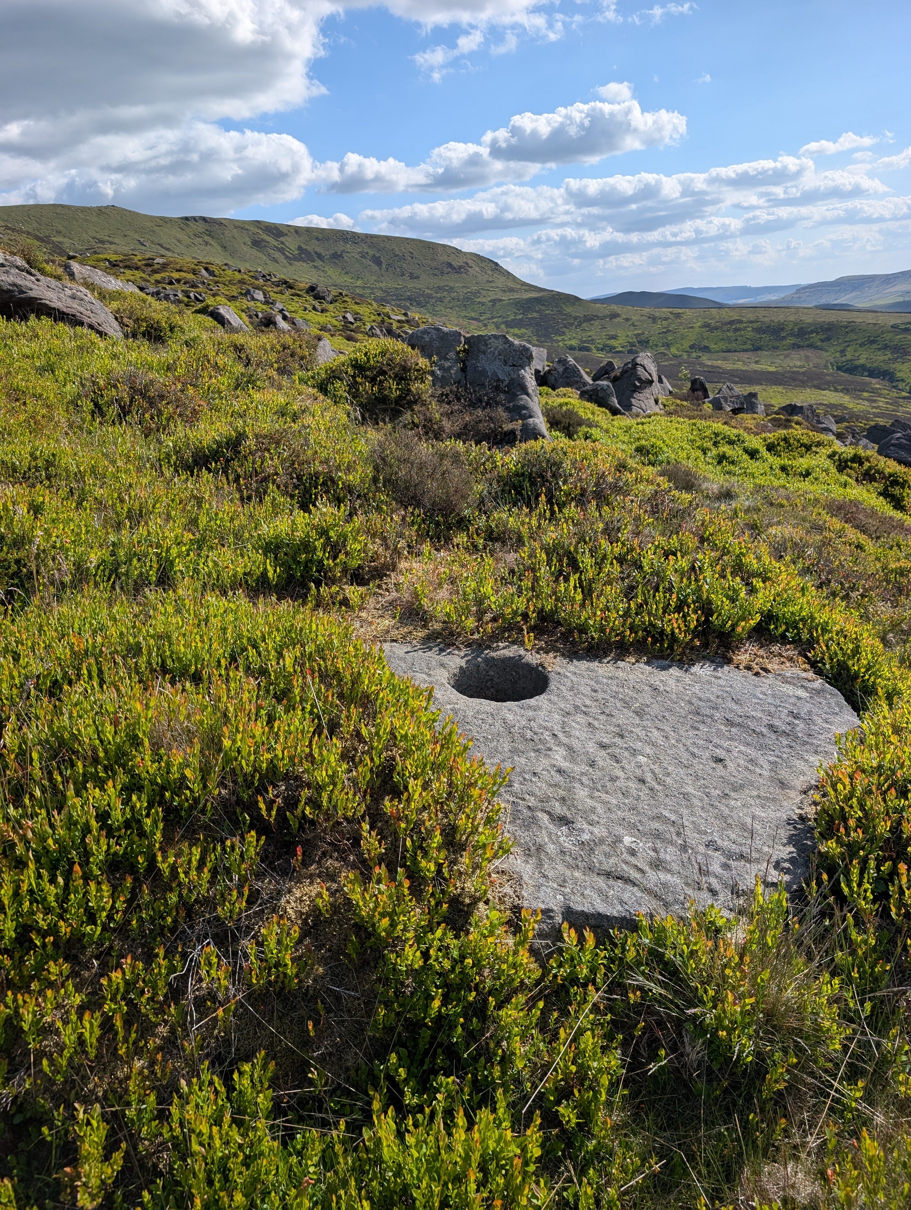
While the stretch between Kinder Low and Red Brook packs dramatic vistas, Cluther Rocks brings quiet mystery. Here, you’ll find subtle signs of ancient industry: the remains of quarrying and millstone production that span from Roman times to the Victorian era.
When demand for gristone slumped, millstones were simply abandoned where they lay. Pause and imagine the shouts of labourers, the clinking sounds of tools on grit, the ache of muscle in cold winds as the quarrymen worked year-round outside. Gritstone quarrying was brutal work, but it shaped the landscape and communities around Kinder.
As you zig-zag along Cluther Rocks, keep an eye out for the Dog Stone (carved boulder with a mysterious purpose) and undulating mounds in the grass denoting ancient settlements and medieval agricultural practices. Little evidence remains about their past today, and according to most archaeologists, it’s better to leave the remnants unturned.

Hydropower
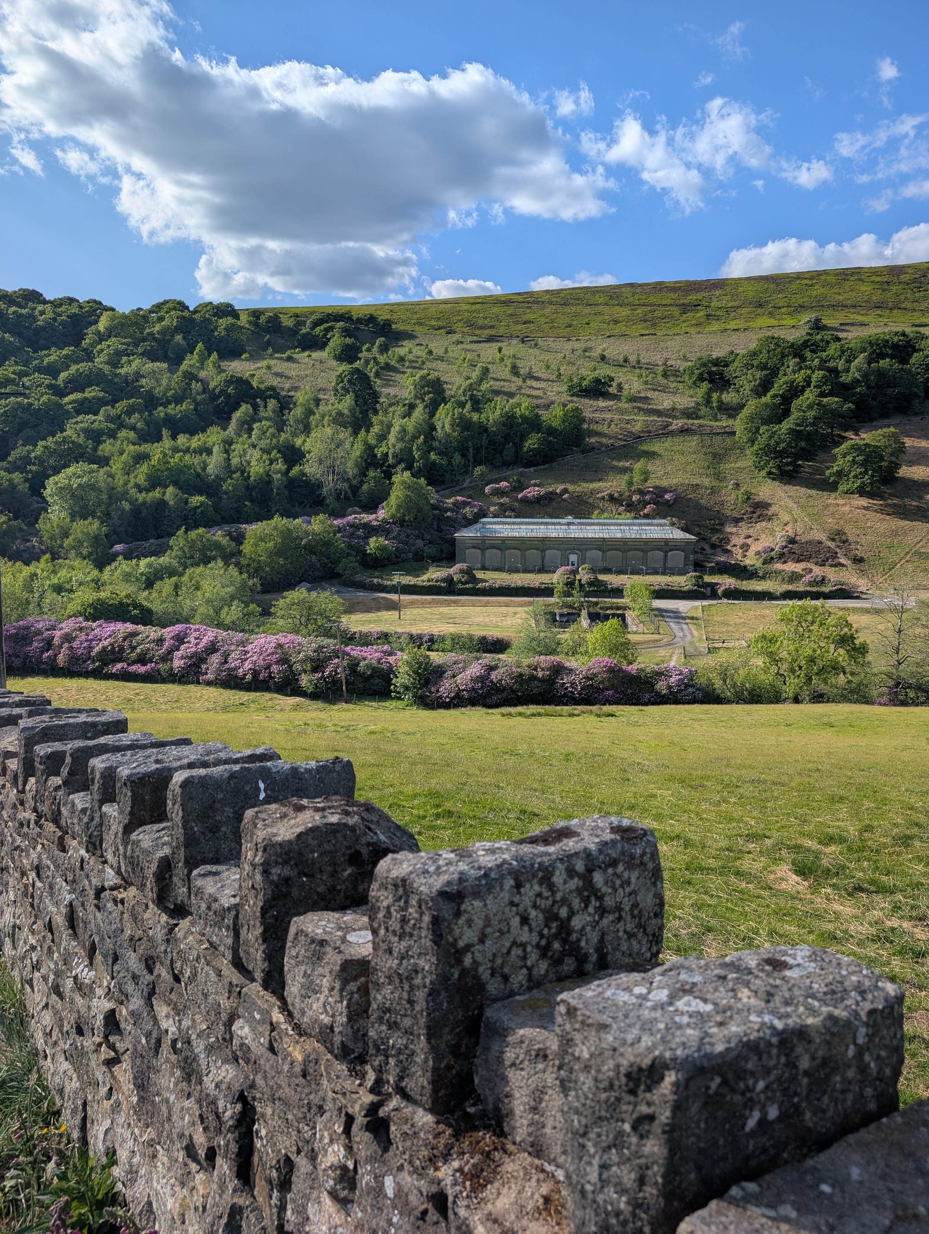
The final section of this circle-themed hike highlights the importance water played in shaping Kinder’s landscape. Kinder Reservoir (built between 1903 and 1911) provides drinking water for the local communities. The ornate Edwardian buildings reflect their ambition at the time, although today hikers may pause and comment that Kinder Reservoir resembles a backdrop to a Wes Anderson film. When framed by rhododendrons in summer, Kinder Reservoir is a stunning spot to pause and catch your breath.
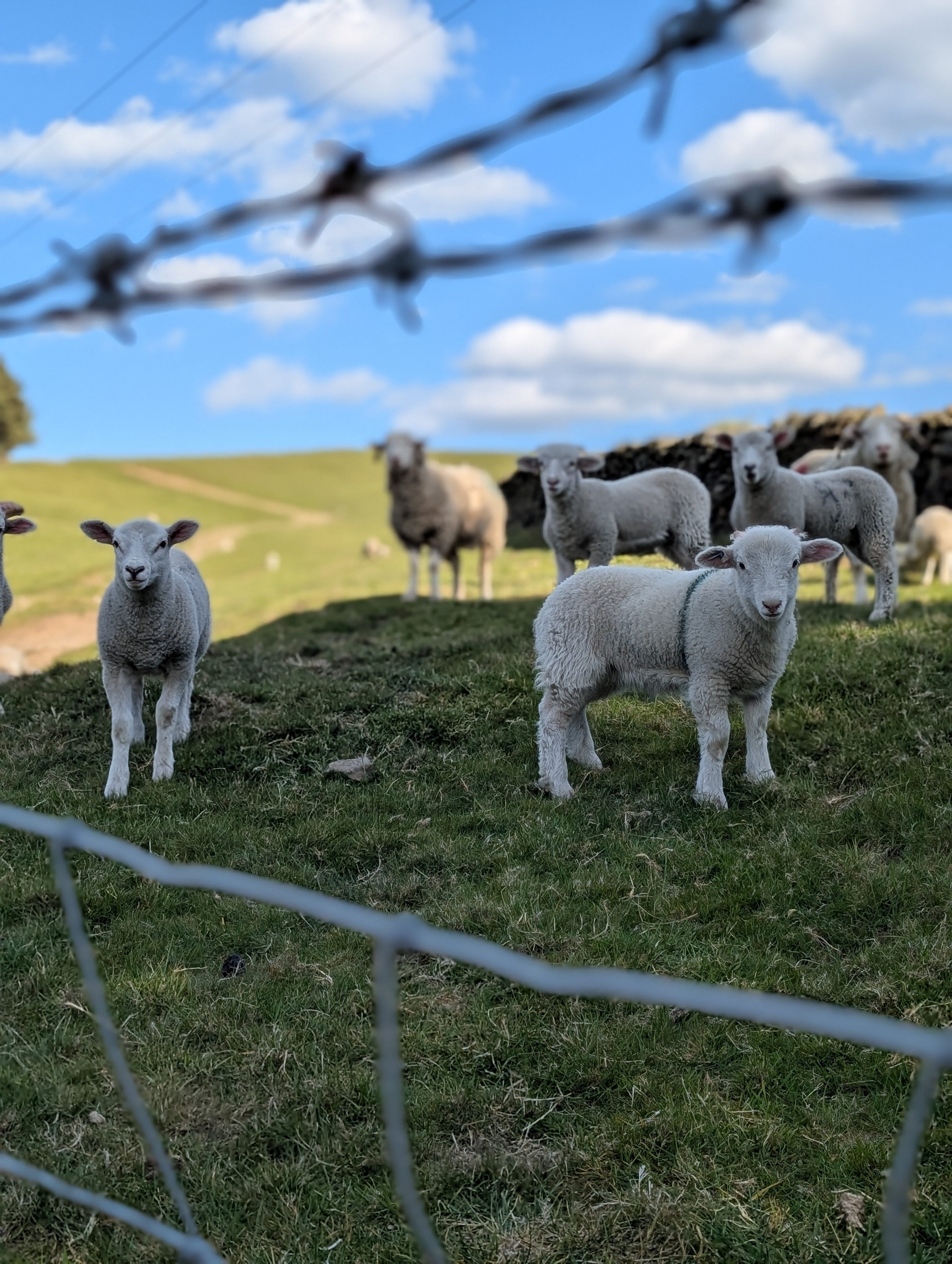
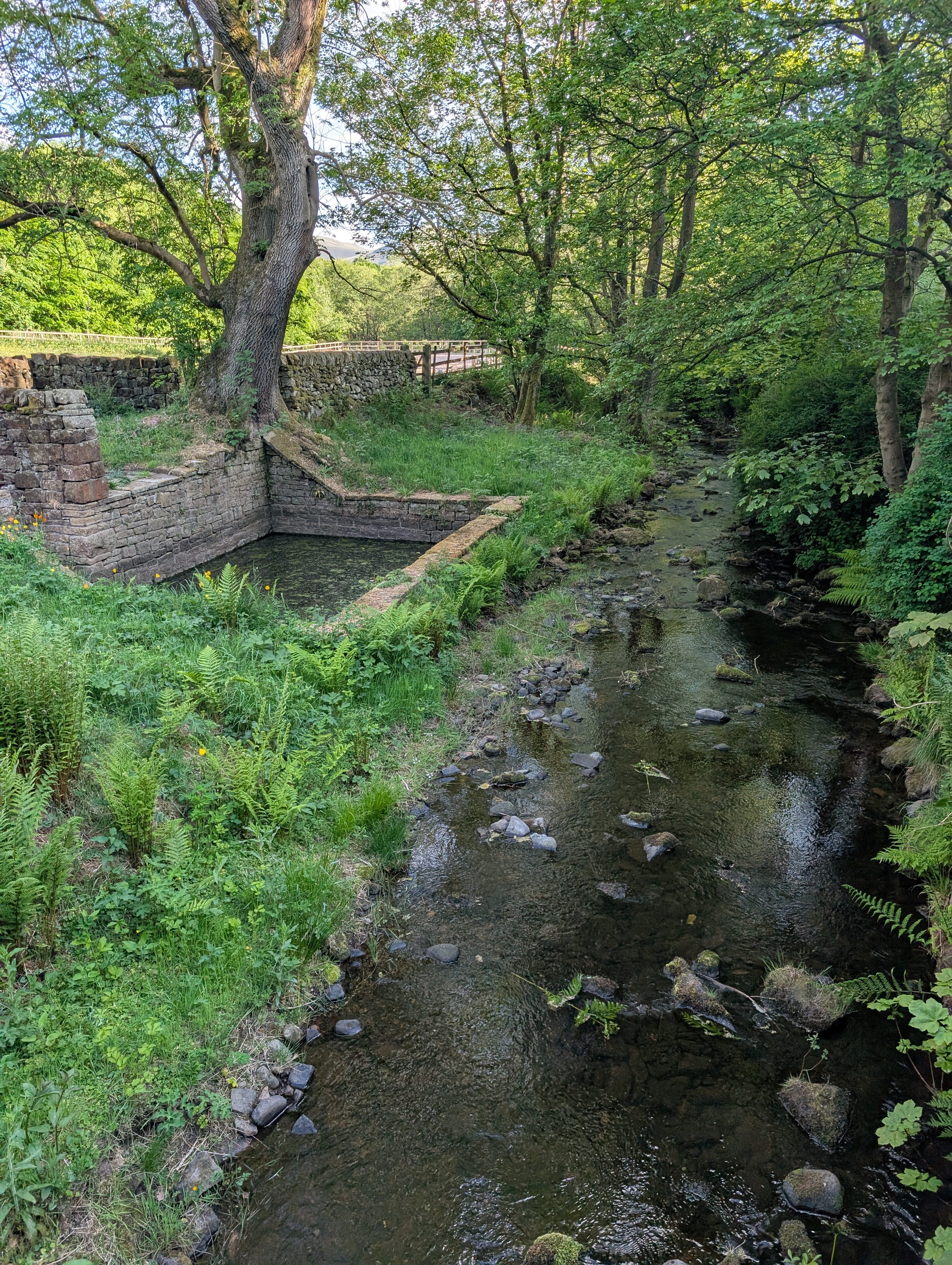
Just beyond Kinder Reservoir Booth Sheepwash sits under a welcome shaded canopy. In the 1900s farmers would bring their flocks to this pool May for a scrubbing before shearing them. Neither sheep nor farmer were fans, but an accidental sheep escape or farmer dunking made it a popular spectator event.
I came down from Kinder Downfall past the reservoir last week and was amazed by the amount of rhododendrons; they looked so out of place but somehow right to welcome me down from the tops.